Author: Farlen Mischel
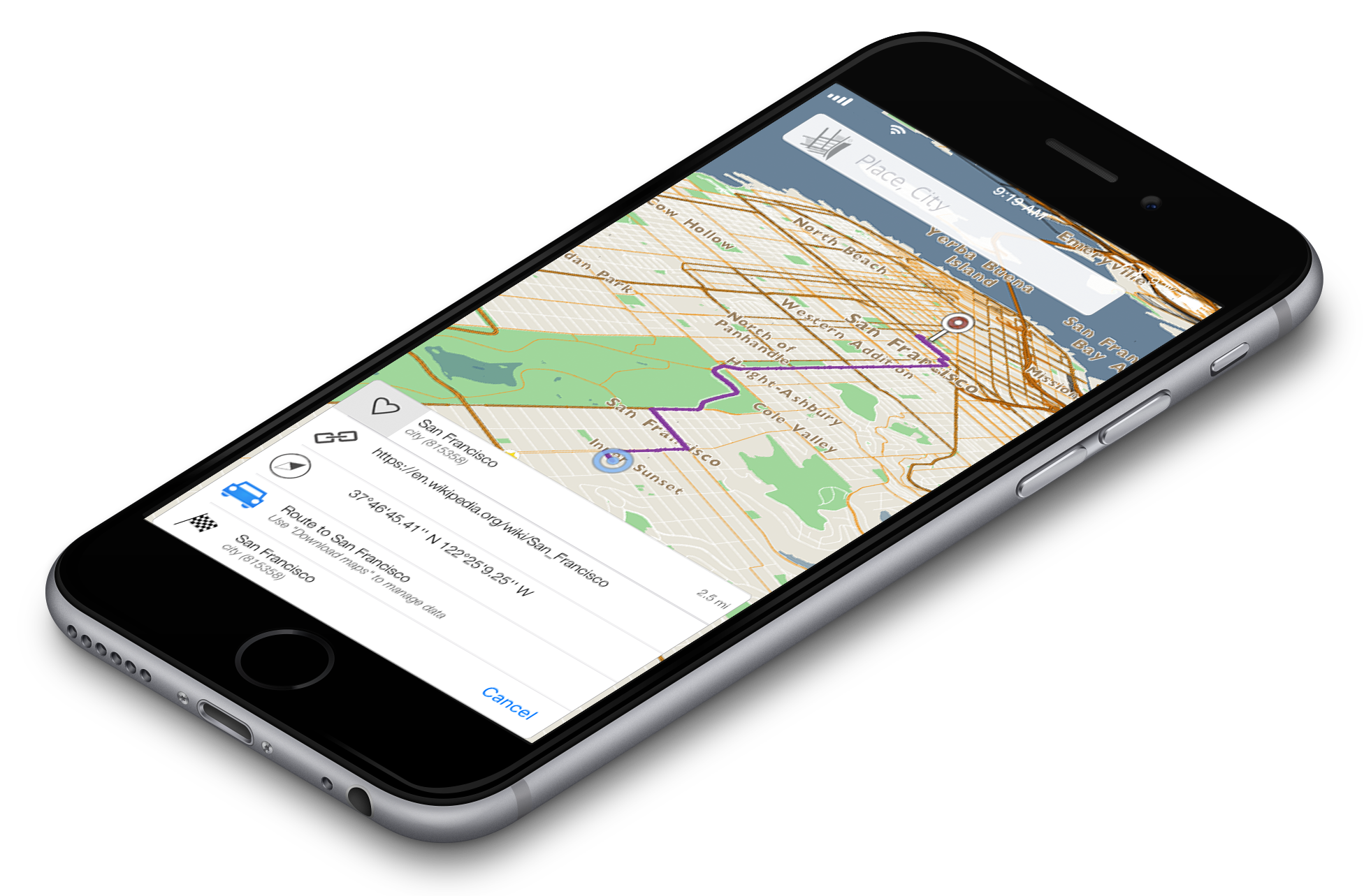
When we began our project 4.5 years ago we had a goal of finding a permanent solution to traffic. Today we are happy to release the next iteration of development for our application. We have finalized a working version of navigation so that our users can get a clear and easy route to their desired location. It is as easy as pressing one button to create a lightning fast route to anywhere you want to go. This is the first step we are taking toward creating a comprehensive navigational product for anyone with a smart device. Our navigational vision will work seamlessly online and offline. This release is our first step to becoming a leader in navigation to provide services to consumers and developers alike.
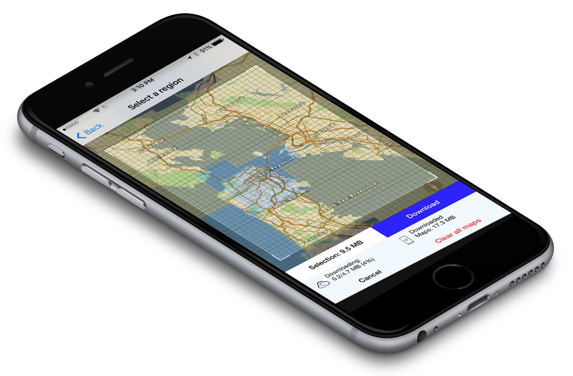 For the past couple of months we have been experimenting with a new design for the offline maps download manager. The idea was to create a UI that was so easy and understandable that non-tech users would know immediately how to use it. After a couple of different iterations and tests, we came to a version which was in-line with the simple usability of our other features. When the user selects “offline maps” they are taken to a overlay of the map. It shows a field of view which can be manipulated completely. Both the size of view and the zoom level of the region that needs to be downloaded, are malleable. This is coupled with a technology that labels downloaded areas blue and un-dowloaded areas yellow. If the user questions whether they have already downloaded a certain map region, all they have to do is see if it is blue. It is a simple feature, but we believe, very useful for usability. An improved user-interface and a few simple features makes the user-experience of the new offline maps manager second to none. It enhances the experience of the whole app and makes the user comfortable where ever they are.
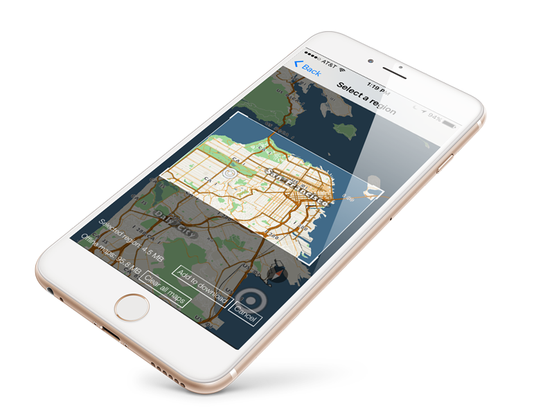
When using kMaps downloading areas is now easier than ever. After navigating to the settings menu, select “download maps” and this simple download manager will pop up. Manipulate the map showing the area to save for offline use and also change the rectangular download window to represent the exact area desired. Once added fell free to add more area and create a download queue. If plans change, cancel the download and select a new area. If the download limit is reached, clear all maps and start fresh or upgrade to unlimited. Our powerful search engine will be available offline for all downloaded areas. We say the simpler the better. Enjoy saving your future trips or daily commute.
After more than a year of reworking different aspects of our maps, a new product is now ready. Since the last release, we decided to buckle down and really listen to our customer feedback to make the maps more functional and beautiful. With this new release we aimed to create a solid foundation to build new features quickly for our users. The goal is to now release a new build every 3-4 weeks with exciting features and fixes. This foundational build offers vivid 3D maps with the ability to manipulate the field of view to whichever angle you need, which is a precursor to our introduction of online/offline navigation and directions. We have also re-imagined the user-interface to make it easy for anyone to use. Our UI upgrades are coupled with a favorites feature that is linked to our redesigned search engine. Enjoy downloading our app online or offline for free and download any size region for future use with our simple download manager. Please don’t hesitate to give us your feedback.
One of the main goals that we have at kMaps is to always be as user-friendly and functional as possible. We want to make ‘getting around,’ as easy as possible. We urge people to give us feedback in order to shape our product to their liking. Since the release of our ‘pilot’ version we’ve had feedback coming in from multiple channels and have considered all of it. People have been expressing to us that one thing they find difficult is to drink a cup of coffee and fully interact with kMaps. Specifically, zooming in and out.
One of the features in kMaps V2, that we’re really proud of, is One Finger Zoom. It does exactly what it sounds like. You are now able to zoom in and out with just one finger. Just lay your finger on the map for 2-3 seconds and then swipe up or down. Voila, you can get where you’re going and have your coffee too.
Enjoy this little video we made showing off One Finger Zoom.
This post discuses the ultimate goals of kMaps. It will touch on the initial ideas which lead to the development of our current product and will briefly discuss its future.
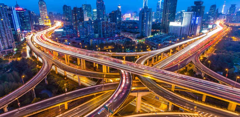
It was an idea that started years ago; a workaround to traffic jams. A thought of clear roads with no break lights in sight. It is a calming feeling, tossing those stressful bursts of road rage to the gutter. Not to be overdramatic, but every driver has been there; being rushed to make an appointment, only to be met around the corner by an army of cars. Why hasn’t anyone solved this issue? Why hasn’t anyone created a way to manage traffic flows? Traffic congestion does not only pertain to cars. What about pedestrian congestion, boat stalls, or plane delays? Why is there not one application to track all the traffic flows on this earth? With a large idea, comes even greater challenges.
The answer to this problem started as a web based solution, three and a half years ago. As development began, the potential user-base, began to change their habits. The mobile market took off and left web in its dust. Smartphones were everywhere and laptops started turning into tablets. The obvious decision was to pivot development to reflect a growing mobile user-base. After six months of development, a mobile platform began to take shape. With time, the first branch of the mobile interface was completed. It was an algorithm, allowing different stages of high quality, complex, vector graphic rendering. In other words, it bore us the possibility of rendering large, quality graphics. This step which will allow us to see traffic in real time, is necessary in order to address the issue of traffic congestion.
At this point, in order to connect to users on a mobile level, the decision was made to focus our attention on the travel industry. This way people would use our maps to help themselves get around. It was a perfect step because now we have a great audience that can interact with our product, while we provide them an essential utility. We then created a second algorithm, which compresses files to a very small size, as an aid to the user. If someone was to walk around with our maps in their pockets, we didn’t want to take up too much of their space. Currently, we have our first release of the app on the market and will soon be coming out with the second version. In addition, we will be releasing our WEB client and will be extending our app to all other mobile phone platformsThe traffic dilemma is a very complex one. It will take time to understand and solve it. We have created a stepping stone to understand how traffic works. Along the way we intend to supply our users with tools such as, offline navigation and fast, quality offline search. In the future, we plan on shifting over to the online maps market offering a vast majority of features, such as, realtime location sharing and tracking, location based texting and video sharing, while also incorporating social platforms. The possibilities are endless to the users ability as we imagine a fully customizable and interactive interface. kMaps will always reflect the wants and needs of its users, so all feedback will be greatly appreciated and considered for newer versions.
For the past two months we have been working very hard to make search available for you to use when our app goes live. We have also been working on its speed and compression. With the release date coming so soon we wanted to show you what will be available to you. Enjoy this video and know that very very soon you will be able to use our app personally on your device.
In this day and age it’s very common to keep your portable device strapped to your hip at all times. People seem to always be listening, sharing, or connecting, at every moment possible. Some say it hinders us and others say it keeps us more connected to the people we love. Whether you agree or disagree with technologies forward progression and dependence on technology, it seems inevitable. Every generation thus far has been moving toward a singular era. An era different from before, one in which convenience is king, the Era of Convenience.
In this new era we as a people resemble the stereotypical lost sheep more than ever. If we lose our phones we struggle to get around, communicate, and even do simple daily tasks. One way that realizes this stereotype is the use of maps. The days of looking at a paper map or a metro map are long gone. Now it’s digital maps on your phone that tell you where you need to go. This rapid progression and dependance on digital maps presents a bit of a problem. What happens when your only source of direction becomes compromised? With spotty internet connections these days, due to phone companies cutting corners on internet infrastructure, this happens all to often.
In recent years there has been an emergence of offline maps. These applications, similar to those of google and apple, are not dependent on internet. They offer the user reliability where ever they choose to go, whether it be on a hike in the middle of the mountains, on an exotic adventure to a new place, or even just as cheap alternative to the data and power sucking alternative. Just like with any new idea, the beginning is crude and rough. With time, however, that which was once crude becomes fine and elegant. Similarly, the beginning offline maps were basic compared with their online counterparts. Now, we are seeing new technologies that allow for elegant and smooth mapping interfaces with out the worry of internet. Hopefully users will become more aware of these apps and become less dependent on internet for their needs.
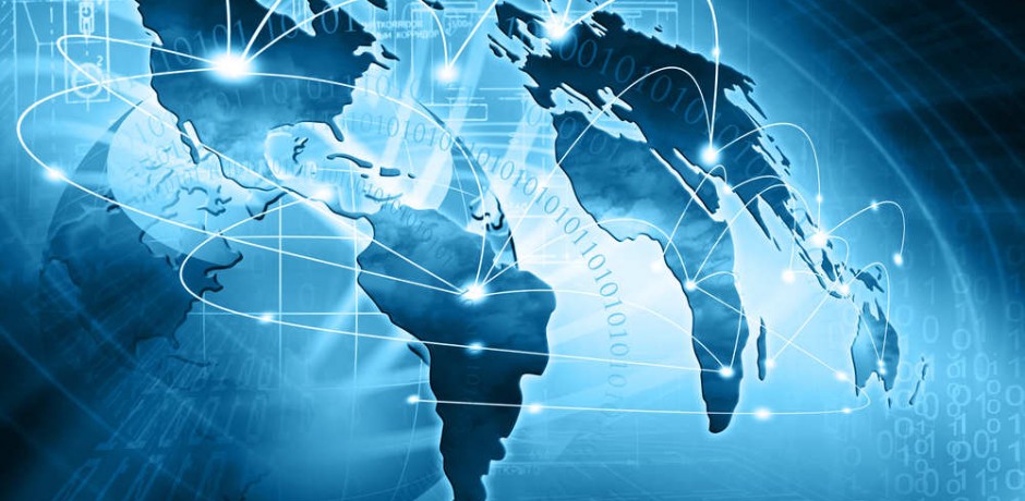
In today’s society we are a people of constant movement. Whether it’s going to the grocery store or driving to your lake house or flying to Germany for a business trip, we are always moving. So when you hear the phrase ‘global traffic mapping’ what do you think of? Maybe road traffic comes to mind, maybe web traffic comes to mind. If you search this phrase on the internet the first result is for web traffic followed by voice traffic and finally, eight results down, the first road traffic result. Results for other types of traffic, such as boats, planes, trains, etc. could not be found. It seems the concept of Global Traffic Mapping is a new one. Essentially, it’s what it sounds like, a map that tracks all movement. We are not talking about social movements, immigration/emigration patterns over time, or movements of civilizations. We are talking about a map that can track peoples movements in real time.
Some companies use an idea similar to this in order to track traffic flows on streets. What we are talking about includes that, but takes it to a global scale. Imagine anonymously transmitting your location from your phone and being apart of a live map of millions of other people who are doing the same. You could zoom in on an area and see dots moving around. The dots are people in cars, people walking, people taking boat rides, even now with wifi on planes people flying. What you would have is a map of worldwide movement or a Global Traffic Map.
The data one could collect from such a map would be endless; traffic flows on streets, realtime freight ship routes, and could even show the efficiency of public transportation. The conclusions drawn from such a tool could increase efficiency in area of our lives that were, before, impossible. Also, on a more whimsical note, it could be a fun way of showing someone where you are. Imagine looking on a map after your loved one takes off for a trip and see their route until they land. Relating to social media, instead of “checking in”, you will be checked in.
We are working toward such a map. This is something we are hoping to accomplish in order to improve your lives and hopefully you will help us too.
kMaps is a simple company with a simple goal: to help as many people get where they are going. This company was started over two and a half years ago when CEO Evgeny Karpov had the idea to map the world and eventually the human brain; but more on that later. Not only did he want everyone to have this information of the world, he wanted people to use it as a tool to improve their lives. He was tired of congested streets and too many wrong turns. The project started as a WEB engine to edit maps but then shifted. After a year of working diligently, he understood that there was a lot of work to be done and by releasing an application, it would get him closer to his goal. Due to a market shift to mobile phones it became clear that in order to pursue this goal a mobile application must be developed.
Versed in high level code and carrying a special algorithm for compression, he started. He began by compressing the data of the world into bite sized pieces. In order to do this he used a very unique technique for compression that he created. It allowed for huge pieces of data to be compressed into small bites. In other words, this process was ideal for laying the foundation for a downloadable offline map. After some setbacks and lots of coffee the first stage of compression was done. The next step was the creation of the unique rendering and data engines.
The engines used in this app were the most difficult challenge throughout its development. First off, the idea was to create one engine that would allow for high quantities of high quality data to be rendered instantaneously, and the second, to create an engine that allowed for quick storage and quick fetching of high quality data. After 1.5 years and countless sleepless nights, the rendering engines were created that allowed for high quality rendering and movement of data. The first engine renders high quality vector graphics while the second can organize, store, and fetch large amounts of data incredibly fast and with ample flexibility. When you put these features together you have the ingredients for a very powerful application with next generation possibilities.
This project started two and a half years ago and is coming to its fruition. Our promise, from the first release to any version in the future, is to help you. You could say it’s a kind of philosophy we have. Much like in the hospitality business where the customer comes first, for us, the user comes first. After all with out your help our dreams of mapping the world can’t succeed.

kMaps is brewed in Prague and San Francisco by Evgeny Karpov and Farlen Mischel