For the past two months we have been working very hard to make search available for you to use when our app goes live. We have also been working on its speed and compression. With the release date coming so soon we wanted to show you what will be available to you. Enjoy this video and know that very very soon you will be able to use our app personally on your device.
BLOG
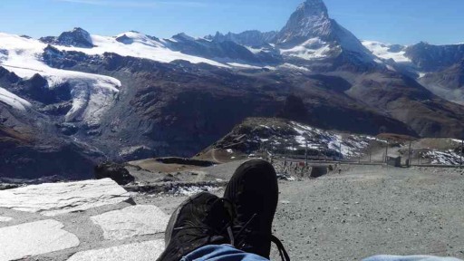
In this day and age it’s very common to keep your portable device strapped to your hip at all times. People seem to always be listening, sharing, or connecting, at every moment possible. Some say it hinders us and others say it keeps us more connected to the people we love. Whether you agree or disagree with technologies forward progression and dependence on technology, it seems inevitable. Every generation thus far has been moving toward a singular era. An era different from before, one in which convenience is king, the Era of Convenience.
In this new era we as a people resemble the stereotypical lost sheep more than ever. If we lose our phones we struggle to get around, communicate, and even do simple daily tasks. One way that realizes this stereotype is the use of maps. The days of looking at a paper map or a metro map are long gone. Now it’s digital maps on your phone that tell you where you need to go. This rapid progression and dependance on digital maps presents a bit of a problem. What happens when your only source of direction becomes compromised? With spotty internet connections these days, due to phone companies cutting corners on internet infrastructure, this happens all to often.
In recent years there has been an emergence of offline maps. These applications, similar to those of google and apple, are not dependent on internet. They offer the user reliability where ever they choose to go, whether it be on a hike in the middle of the mountains, on an exotic adventure to a new place, or even just as cheap alternative to the data and power sucking alternative. Just like with any new idea, the beginning is crude and rough. With time, however, that which was once crude becomes fine and elegant. Similarly, the beginning offline maps were basic compared with their online counterparts. Now, we are seeing new technologies that allow for elegant and smooth mapping interfaces with out the worry of internet. Hopefully users will become more aware of these apps and become less dependent on internet for their needs.

In today’s society we are a people of constant movement. Whether it’s going to the grocery store or driving to your lake house or flying to Germany for a business trip, we are always moving. So when you hear the phrase ‘global traffic mapping’ what do you think of? Maybe road traffic comes to mind, maybe web traffic comes to mind. If you search this phrase on the internet the first result is for web traffic followed by voice traffic and finally, eight results down, the first road traffic result. Results for other types of traffic, such as boats, planes, trains, etc. could not be found. It seems the concept of Global Traffic Mapping is a new one. Essentially, it’s what it sounds like, a map that tracks all movement. We are not talking about social movements, immigration/emigration patterns over time, or movements of civilizations. We are talking about a map that can track peoples movements in real time.
Some companies use an idea similar to this in order to track traffic flows on streets. What we are talking about includes that, but takes it to a global scale. Imagine anonymously transmitting your location from your phone and being apart of a live map of millions of other people who are doing the same. You could zoom in on an area and see dots moving around. The dots are people in cars, people walking, people taking boat rides, even now with wifi on planes people flying. What you would have is a map of worldwide movement or a Global Traffic Map.
The data one could collect from such a map would be endless; traffic flows on streets, realtime freight ship routes, and could even show the efficiency of public transportation. The conclusions drawn from such a tool could increase efficiency in area of our lives that were, before, impossible. Also, on a more whimsical note, it could be a fun way of showing someone where you are. Imagine looking on a map after your loved one takes off for a trip and see their route until they land. Relating to social media, instead of “checking in”, you will be checked in.
We are working toward such a map. This is something we are hoping to accomplish in order to improve your lives and hopefully you will help us too.
kMaps is a simple company with a simple goal: to help as many people get where they are going. This company was started over two and a half years ago when CEO Evgeny Karpov had the idea to map the world and eventually the human brain; but more on that later. Not only did he want everyone to have this information of the world, he wanted people to use it as a tool to improve their lives. He was tired of congested streets and too many wrong turns. The project started as a WEB engine to edit maps but then shifted. After a year of working diligently, he understood that there was a lot of work to be done and by releasing an application, it would get him closer to his goal. Due to a market shift to mobile phones it became clear that in order to pursue this goal a mobile application must be developed.
Versed in high level code and carrying a special algorithm for compression, he started. He began by compressing the data of the world into bite sized pieces. In order to do this he used a very unique technique for compression that he created. It allowed for huge pieces of data to be compressed into small bites. In other words, this process was ideal for laying the foundation for a downloadable offline map. After some setbacks and lots of coffee the first stage of compression was done. The next step was the creation of the unique rendering and data engines.
The engines used in this app were the most difficult challenge throughout its development. First off, the idea was to create one engine that would allow for high quantities of high quality data to be rendered instantaneously, and the second, to create an engine that allowed for quick storage and quick fetching of high quality data. After 1.5 years and countless sleepless nights, the rendering engines were created that allowed for high quality rendering and movement of data. The first engine renders high quality vector graphics while the second can organize, store, and fetch large amounts of data incredibly fast and with ample flexibility. When you put these features together you have the ingredients for a very powerful application with next generation possibilities.
This project started two and a half years ago and is coming to its fruition. Our promise, from the first release to any version in the future, is to help you. You could say it’s a kind of philosophy we have. Much like in the hospitality business where the customer comes first, for us, the user comes first. After all with out your help our dreams of mapping the world can’t succeed.

© 2018 kMaps LLC. All rights reserved.
kMaps is brewed in Prague and San Francisco by Evgeny Karpov and Farlen Mischel
kMaps is brewed in Prague and San Francisco by Evgeny Karpov and Farlen Mischel